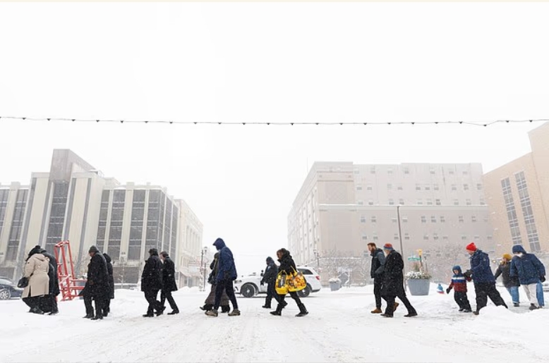
Weather experts are issuing grave warnings to Americans to not make any travel plans over the weekend as a powerful winter storm is set to hit multiple states.
As much as 20 inches of heavy snow, sleet, and ice are predicted to sweep across most of the eastern half of America, as Arctic air from Canada is set to travel south.
The winter storm, named Fern, is predicted to be one of the biggest in recent memory – with meteorologists urging people to prepare for days without power in their homes.
‘This is not good,’ Weather Channel meteorologist Jordan Steele wrote on X. ‘ Plan now! Plan for going day(s) without power this weekend. School cancellations next week.’
‘Do not plan a road trip this weekend. This could be a situation where people get stuck on the highway.’
The National Weather Service is predicting more than a foot of heavy snow in places that will cause hazardous conditions and reduced visibility over the weekend.
Millions of people – from the east of Arizona all the way to southern edge of New Hampshire – are being told to hunker down and avoid travel until the icy storm passes.
‘All model guidance shows arctic air making it down to the Gulf and East Coasts, which will clash with southern stream energy to produce a high impact winter storm across the southern tier,’ the center wrote on Tuesday morning.

Heavy snow, sleet and ice are predicted to sweep across most of the eastern half of America as Arctic air from Canada is set to travel south


The center is predicting heavy snow freezing rain and sleet, as well as hazardous conditions and reduced visibility over the upcoming weekend

Confidence on ‘bad impacts’ is high, according to WFMY meteorologist Tim Buckley, who wrote on X that the ‘incredible’ amounts of moisture and ‘tons of durable’ cold air at the surface point to a bad storm.
‘Models forecasting one to two inches of liquid (usually equals 10-20 inches of snow, or three to six inches of sleet, or up to one inch of ice),’ Buckley wrote, adding that the amount remains unclear.
Friday
On Friday, heavy snow, sleet and freezing rain is expected to lash the Midwest, Southern Rockies, Plains and Mid-South and begin moving toward the East Coast.
Northern Texas, Oklahoma and Kansas to the lower-Mississippi Valley will see snow and ice beginning on Friday into the night.
Temperatures are expected to reach around 30 degrees below average in parts of Dakota, Minnesota, Iowa, Wisconsin and northern Illinois, CNN reported.
Denver is set to see temperatures in the teens, while Nashville, Oklahoma City and New York City float around 30 degrees Fahrenheit. Chicago’s Friday forecast is predicting temperatures reaching negative six degrees.
Winds are set to worsen the cold temperatures, with the upper Midwest seeing wind chills between 30 and 50 degrees below zero, according to the outlet.
North Texas Weather Center said that the ‘very serious’ and ‘historic’ storm is looking ‘more likely as we get closer to Friday.’
‘Models show either 1in+ of freezing rain or 12in+ of sleet and snow, and that’s being conservative,’ the center posted on X.
‘[Precipitation] will stick for days as highs will remain in the 20’s for 90hrs+.’
The center added that they ‘definitely expect’ all three forms of precipitation, starting with freezing rain as well as backend snow of around one to four inches.

Temperatures are expected to reach around 30 degrees below average in parts of Dakota, Minnesota, Iowa, Wisconsin and northern Illinois

On Friday, heavy snow, sleet and freezing rain is expected to lash the Midwest, Southern Rockies/Plains and Mid-South and begin moving toward the East Coast

North Texas Weather Center said that the ‘very serious’ and ‘historic’ storm is looking ‘more likely as we get closer to Friday’
Saturday
While the weekend moves on, Saturday will see areas such as northern Texas, Louisiana, North Carolina and Virginia battered by the storm.
Dozens of locations are expected to reach their coldest temperatures on record on Saturday, with the Twin Cities expected to see temperatures as low as near negative 20 degrees.
Denver is expected to reach ten degrees, Oklahoma City is set for five degrees, Nashville will see 17 degrees and New York City is forecast for eleven degrees, while Chicago will see negative eight.
The worst of the cold temperatures are predicted to push toward the South and into the Northeast, with temperatures set to be 15 to 30 degrees lower than average.
Meteorologist Jesse Walker said on X that Saturday is looking to be ‘a mess’ according to radar maps.
By Saturday night, the winter chaos may reach the Texas Gulf Coast, southwestern Louisiana, central Mississippi, northern Alabama, northern Georgia and South Carolina, according to The Weather Channel.
Snow may intensify in mid-Atlantic states and continue on into the mid-South, including Oklahoma and Texas.

Dozens of locations are expected to reached their coldest temperatures on record on Saturday, with the Twin Cities expected to see temperatures as low as near negative 20 degrees

Meteorologist Jesse Walker said that Saturday is looking to be ‘a mess’ according to radar maps

While heavy snow is possible in the East, precipitation may gradually diminish by Sunday night. Current forecasts remain unclear for the progression of the storm
Sunday
As Sunday rolls in, snow is expected across the Northeast as wind chills for the Northeast and New England are forecast to reach below zero.
Texas is set to see the end of winter precipitation, but will persist for areas of Louisiana, Tennessee Valley, Appalachians and the Carolinas.
While heavy snow is possible in the East, precipitation may gradually diminish by Sunday night. Current forecasts remain unclear for the progression of the storm.
Snow could last until Monday along the East Coast, CNN reported, depending on how fast moving the storm is.
Source: Daily Mail
Stay ahead with the latest updates!
Join The Podium Media on WhatsApp for real-time news alerts, breaking stories, and exclusive content delivered straight to your phone. Don’t miss a headline — subscribe now!
Chat with Us on WhatsApp


